After taking a family vacation on the northern side of the Smokies, by Gatlinburg TN, I really wanted to see the southern side of the Park. Honestly, I was also getting anxious about being trapped in the house when I started my third trimester. So I planned a quick weekend trip to Cherokee/Bryson City NC to do a couple of fun and easy family hikes.
Where We Stayed
I had some hotel points to burn so we stayed at the Fairfield Marriott Hotel in Cherokee NC. The funny thing was the hotel was literally across the street from one of two casinos in the entire state of North Carolina. We didn’t go in… the buffet was closed, which disappointed my husband.
Pros of Staying in Cherokee
- Despite the large casino, Cherokee and the surrounding towns have a small-town feel, unlike Gatlinburg and Pigeon Forge. Since we were there in the off season they also were not crowded. During the summer Cherokee and surrounding areas can be busy with tourists.
- In Cherokee, the grocery store was very close, making it easy to quickly stock up on fresh fruits and snacks.
- It was a short drive from Cherokee to Bryson City and the trail-heads.
Cons of Staying in Cherokee
- There were few restaurant options for eating out in Cherokee. Since we were staying at a hotel with no kitchen in the room, we really just wanted easy access to restaurants. I kinda felt like there were limited options in the area, and if could I would rather have a place with a kitchen to avoid dealing with it all together.
Hiking Trails
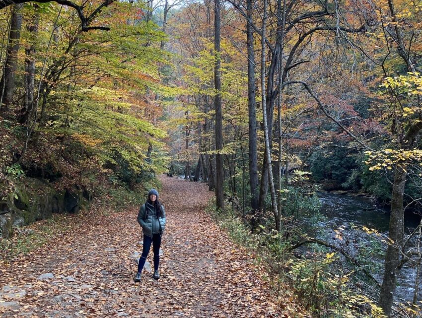
Deepcreek Loop Trail
Map: Great Smoky Mountains National Park Map & Day Hikes
Trail type: Loop
Length: 4.9 miles
Difficulty: moderate
Parking Lot/GPS:
Trail-head: In the parking lot there are 2 trail-heads, you want take the one that follows Deep Creek upstream.
Trail Blazes: none
Main features on the hike:
- Heavily trafficked trail very close to Bryson City.
- Two waterfalls – Toms Branch Falls and Indian Creek Falls. Both waterfalls are easily reachable even if you don’t want to hike the entire loop.
- Several benches to stop, relax, and enjoy the river or waterfalls.
- The trail is wide, easy for toddlers and children to enjoy.
Overview
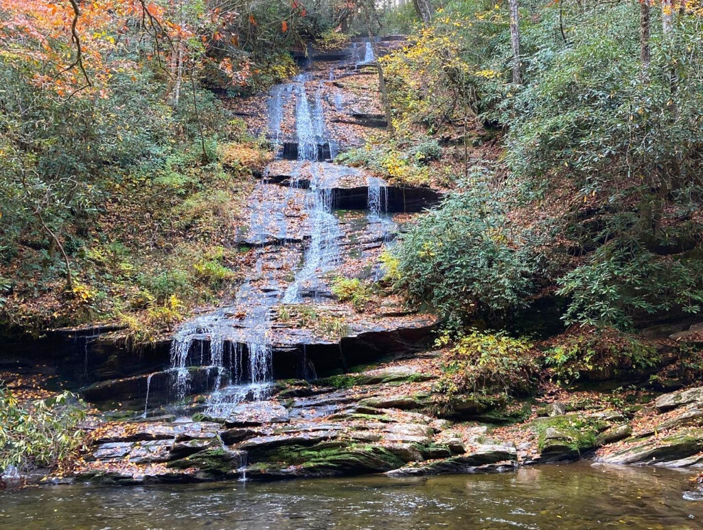
Starting at the trail-head, you will quickly hit Tom Branch Falls on the right. Keep following the trail to reach the Indian Trail Junction. At this junction don’t forget to stop and enjoy Indian Creek Falls. Keep hiking and turn right at the Stone Pile Gap Trail to start heading up and closing the loop. When you reach the top of the hill you will run into the junction to Thomas Divide Trail.
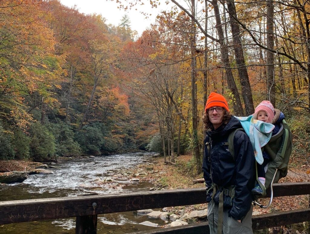
Traffic on Thomas Divide Trail was sparse and so we found this to be a great spot to take a picnic. Continue following Stone Pile Gap Trail back down and you’ll hit Deep Creek again. Follow the junction to the left to start closing the loop.
Our Thoughts?
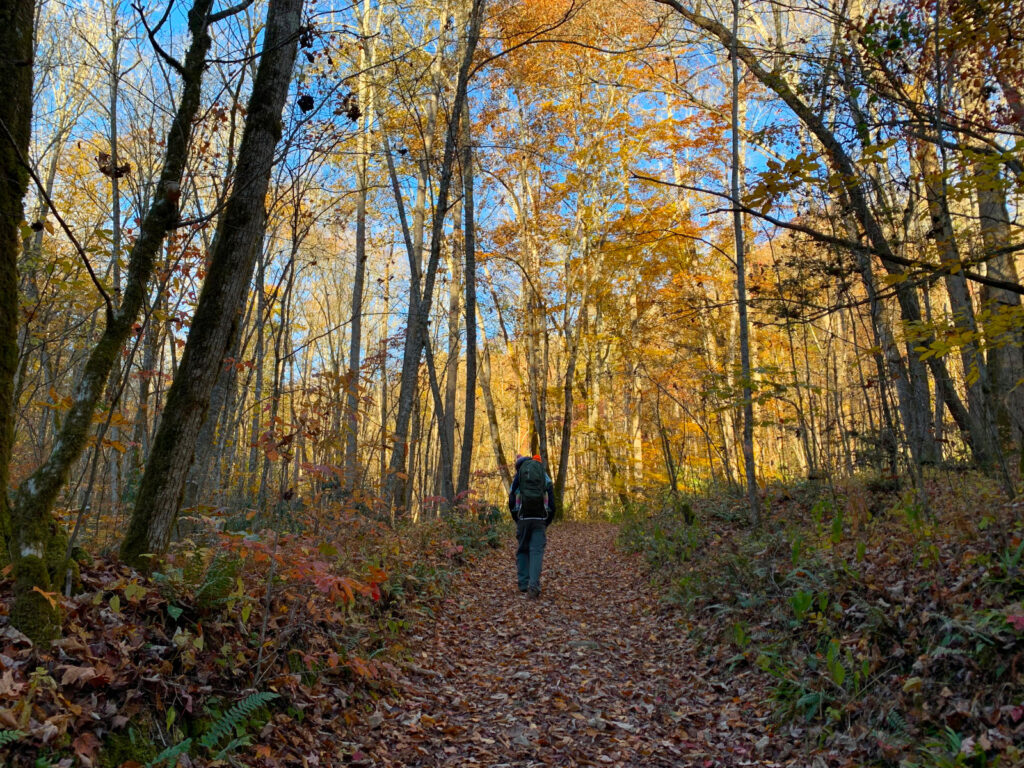
Everyone recommends hiking it in the spring, but I thought it was particularly beautiful in the fall. Visiting the trail the first week of November the fall leaf colors were still present. In the morning the temperature was crisp, close to freezing, but gradually warmed up to to 55 F.
I would recommended hiking the loop counter-clock wise. There is a little elevation gain on the trail and going counter clockwise just makes it a little easier.
We thought the trail was a great break from our usual strenuous hikes. It was really easy for our toddler to run around and explore.
It does get crowded and we recommend showing up early. Being early birds on the trail we didn’t run into too many groups in the beginning and could enjoy the trail to ourselves.
I would recommended bringing a map just so you don’t get confused at all the junctions. You don’t want to end up wandering off into the Smokies.
Mingus Creek Trail
Map: Great Smoky Mountains National Park Map & Day Hikes
Trail type: One-way
Length: 5.9 miles
Difficulty: moderate, slightly strenuous
Parking Lot/GPS: Google Maps to the Parking Lot / 35.5209928,-83.3088701,919
Trail Blazes: none
Main features on the hike:
- Close to the National Park Entrance on US-441
- Elk as you pass the Oconaluftee Visitor Center. There are pull offs to the side of the road to get out and take pictures from a safe distance.
- Can visit the Mingus Mill, still operational and managed by the National Park .
- Trail-head is very close to Cherokee NC
Overview
This is a lightly trafficked one-way trail.
A majority of the cars in the parking lot are there to see the Mingus Mill. The Mingus Mill is a water powered mill built in 1886, that is still running today by the National Park. They do have a number of products for sale including flours and cornmeal. The proceeds go to the park.
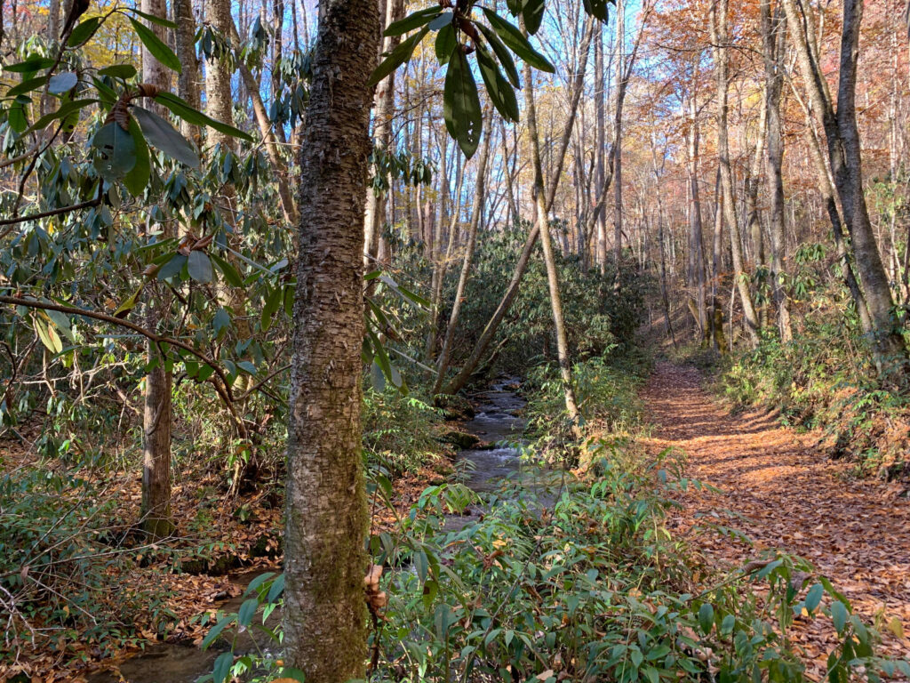
For most of the trail you will follow Mingus Creek, which includes several smallish creek crossings with no bridges. Depending on the amount of rain in the area hikers have said it’s best to have water proof shoes. We didn’t find it necessary on this trip.
The trail starts out pretty wide, but as the gradual elevation gain begins it starts to narrow down, and will eventually start to become quite rocky/rooty.
A majority of the hike is not strenuous. However, once you reach the switchbacks towards the end of the trail it will quickly become strenuous. The trail itself it not particularly difficult to walk, it’s just steep.
At the top of the mountain, you will hit another junction. With the extra space this can be a good spot to stop for a picnic before heading back down.
Our Thoughts
We mostly did this trail because the trail head is very close to Cherokee and we wanted to do a hike before having to head home.
It was a very peaceful hike in the morning, crisp and cold with beautiful fall colors. For most of the morning we didn’t see another hiker until around 11 am.
The switchbacks were a little painful. They kept teasing us like we were about to make it to the top, but it just kept going. There wasn’t much to see at the top. We could see the mountains a little through the canopy but it’s not a bald. We mostly went up there as one last goodbye before heading home.
Seeing the elk was a huge surprise to us! Most of the herd was out in a field, but a few were eating away in the median of the road. We obviously didn’t dare to get out of the car close to Elk, but some definitely were gutsy enough to do it. When there was enough distance we could pull over to get a closer look at the herd in the field. The National Park Service does put up signs warning not to enter the field. Don’t mess with the Elk! Hopefully this is stating the obvious. It was extremely cool to see all the semi-professional hobbyists out with fancy cameras taking photos.